The goal of this Training and Outreach Plan is to increase the overall awareness and use of the WRAMP datasets and tools in support of wetland resource planning, management, and project performance tracking in California. Specifically, a near-term goal is to develop modular training sessions that can be linked together in different ways to customize how the datasets, monitoring methods, and online tools might be used for different purposes.
NOAA recently announced that it is awarding a $3-million grant, through its Monitoring and Event Response Research Program (MERHAB) to support the development of a harmful algal bloom (HAB) monitoring program for the San Francisco Estuary. The project, led by scientists at the San Francisco Estuary Institute (SFEI), US Geological Survey, and California Department of Water Resources (DWR), will leverage on-going research and monitoring activities in the Bay and Delta to build a robust system-wide HAB monitoring program for the Estuary.
CARI is a Geographic Information System (GIS) dataset of surface waters and their riparian areas consisting of polygon and line features with data-rich attributes that can be used for developing broad- or fine-scale landscape summaries of aquatic features. CARI is a seamless statewide map compiled from multiple data sources and standardized to a common classification system.
Featured in the Los Angeles Times, Mercury News, San Francisco Chronicle, San Francisco Examiner, KneeDeep Times, Marin Independent Journal, KQED, KALW, and ABC News, a new study sheds light on the hazards presented by rising groundwater.
The response of shallow groundwater to sea-level rise is a relatively new field of study. For low-lying coastal communities, sea-level rise adaptation efforts must consider the potential for groundwater rise to avoid maladaptation. The need to better understand this slow and chronic threat was identified as a critical data gap in the San Francisco Bay Area’s (Bay Area’s) adaptation efforts during the Bay Area Groundwater and Sea-Level Rise Workshop in 2019.
Pathways Climate Institute LLC (Pathways) and the San Francisco Estuary Institute (SFEI) gathered and analyzed multiple data sets and collaborated with city and county partners to analyze and map the existing “highest annual” shallow groundwater table and its likely response to future sea-level rise. This effort covers four counties (Alameda, Marin, San Francisco, San Mateo) and was funded by the Bay Area Council’s California Resilience Challenge. The study focused on the San Francisco Bay side of each county and does not include the Pacific coastline of Marin, San Francisco, nor San Mateo Counties. An advisory committee composed of city and county representatives provided essential support by gathering data and reviewing depth-to-groundwater maps. Additional academic and agency advisors participated in project team meetings and informed project direction. This effort produced the following publicly available data and online tools to support adaptation efforts:
Existing and future condition depth to groundwater GIS data available for download (geodatabase format).
A StoryMap providing background information and graphical representations of the processes and impacts of groundwater rise.
Web maps showing: (1) existing depth to groundwater; and (2) a comparison of the extent of emergent groundwater to the extent of coastal flooding under various sea-level-rise scenarios.
This report demonstrates a possible watershed-based approach to evaluating mitigation sites using the California Rapid Assessment Method (CRAM). The Santa Clara Valley Water District (Valley Water) is leading the Llagas Creek Flood Control Project in the upper Pajaro River watershed, Santa Clara County, CA. Mitigation for the Project involves enhancing riverine wetlands on-site (within the flood control channel) and restoring riverine wetlands and enhancing depressional wetlands at Lake Silveira, in the Llagas Creek watershed. Valley Water is incorporating CRAM into its planning and assessment of mitigation efforts and Valley Water's Priority D.5 Project's Pajaro River Watershed ambient stream condition survey (2015) provided the watershed context for evaluating project conditions against the general ecological conditions of streams within the watershed - employing CRAM. This WRAMP demonstration compared pre-project ecological condition assessments (employing CRAM) from the project's impact and mitigation sites to ambient watershed conditions and estimated the amount of ecological lift expected in the future as a result of the planned mitigation and restoration efforts.
This dataset includes depth-to-groundwater maps produced by Pathways Climate Institute and San Francisco Estuary Institute under a grant from the Bay Area Council's California Resilience Challenge. For more information, please visit the project page.
Each link below is a zipped file containing a geodatabase (GDB). There is one zip file for each county covered by this analysis. Each zipped GDB contains:
 The goal of this Training and Outreach Plan is to increase the overall awareness and use of the WRAMP datasets and tools in support of wetland resource planning, management, and project performance tracking in California. Specifically, a near-term goal is to develop modular training sessions that can be linked together in different ways to customize how the datasets, monitoring methods, and online tools might be used for different purposes.
 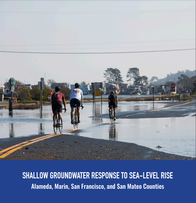 The response of shallow groundwater to sea-level rise is a relatively new field of study. For low-lying coastal communities, sea-level rise adaptation efforts must consider the potential for groundwater rise to avoid maladaptation. The need to better understand this slow and chronic threat was identified as a critical data gap in the San Francisco Bay Area’s (Bay Area’s) adaptation efforts during the Bay Area Groundwater and Sea-Level Rise Workshop in 2019.