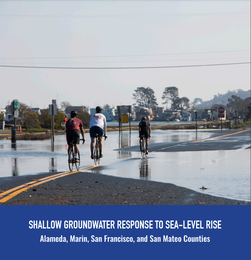
The response of shallow groundwater to sea-level rise is a relatively new field of study. For low-lying coastal communities, sea-level rise adaptation efforts must consider the potential for groundwater rise to avoid maladaptation. The need to better understand this slow and chronic threat was identified as a critical data gap in the San Francisco Bay Area’s (Bay Area’s) adaptation efforts during the Bay Area Groundwater and Sea-Level Rise Workshop in 2019.
Pathways Climate Institute LLC (Pathways) and the San Francisco Estuary Institute (SFEI) gathered and analyzed multiple data sets and collaborated with city and county partners to analyze and map the existing “highest annual” shallow groundwater table and its likely response to future sea-level rise. This effort covers four counties (Alameda, Marin, San Francisco, San Mateo) and was funded by the Bay Area Council’s California Resilience Challenge. The study focused on the San Francisco Bay side of each county and does not include the Pacific coastline of Marin, San Francisco, nor San Mateo Counties. An advisory committee composed of city and county representatives provided essential support by gathering data and reviewing depth-to-groundwater maps. Additional academic and agency advisors participated in project team meetings and informed project direction. This effort produced the following publicly available data and online tools to support adaptation efforts:
Existing and future condition depth to groundwater GIS data available for download (geodatabase format).
A StoryMap providing background information and graphical representations of the processes and impacts of groundwater rise.
Web maps showing: (1) existing depth to groundwater; and (2) a comparison of the extent of emergent groundwater to the extent of coastal flooding under various sea-level-rise scenarios.
This report demonstrates a possible watershed-based approach to evaluating mitigation sites using the California Rapid Assessment Method (CRAM). The Santa Clara Valley Water District (Valley Water) is leading the Llagas Creek Flood Control Project in the upper Pajaro River watershed, Santa Clara County, CA. Mitigation for the Project involves enhancing riverine wetlands on-site (within the flood control channel) and restoring riverine wetlands and enhancing depressional wetlands at Lake Silveira, in the Llagas Creek watershed. Valley Water is incorporating CRAM into its planning and assessment of mitigation efforts and Valley Water's Priority D.5 Project's Pajaro River Watershed ambient stream condition survey (2015) provided the watershed context for evaluating project conditions against the general ecological conditions of streams within the watershed - employing CRAM. This WRAMP demonstration compared pre-project ecological condition assessments (employing CRAM) from the project's impact and mitigation sites to ambient watershed conditions and estimated the amount of ecological lift expected in the future as a result of the planned mitigation and restoration efforts.
This dataset includes depth-to-groundwater maps produced by Pathways Climate Institute and San Francisco Estuary Institute under a grant from the Bay Area Council's California Resilience Challenge. For more information, please visit the project page.
Each link below is a zipped file containing a geodatabase (GDB). There is one zip file for each county covered by this analysis. Each zipped GDB contains:
Despite California's data-rich environment, there are still many obstacles when trying to access and understand pesticide data at the nexus of water quality, ecological effects, and human health. We recognize a need to fill data gaps, not necessarily by collecting new data, but by better leveraging information already technically in the public domain. The goal of this project is to bring pesticide reporting, occurrence, and toxicity data together in ways that yield insights and meet the expressed needs of stakeholders in clear, efficient, credible, and repeatable ways.
This project will build on existing projects funded by the CA State Water Board, Ocean Protection Council, Sonoma Ecology Center, and Sonoma County to produce a basemap of aquatic resources, using the updated Standard Operating Procedures (SOP) of the California Aquatic Resource Inventory (CARI), including at-risk waters and their riparian areas, to support the Russian River Regional Monitoring Program (R3MP). The main tasks of the project are to:
This report describes the updates to the vernal pool habitat map, the development of the ambient baseline ecological condition survey of vernal pool systems within the Central Valley, and the development and results of the habitat development curve. A fictional project example shows how CRAM and the vernal pool complex CDFs and HDCs can help project proponents and the regulatory agencies think critically about project designs (using CRAM Attributes and Metrics as a standard measure), evaluate project conditions within a regional landscape context, and monitor project performance over time to ensure that project goals are met.
Funding for this report was provided through an agreement with the U.S. Environmental Protection Agency (USEPA). This report does not necessarily reflect the views and policies of USEPA nor does the mention of trade names or commercial products within this report constitute endorsement or recommendation for use.
This page provides public access to tabular datasets for the CRAM Habitat Development Curves (HDCs) and statewide and regional probablity based ambient survey Cumulative Distribution Function estimate curves (CDFs) found in EcoAtlas.
The California Wetland Program Plan (WPP) seeks to strengthen protection for wetlands in many ways, including building capacity to track the net benefits of wetland policies and programs by employing aspects of the State’s Wetlands and Riparian Area Monitoring Plan (WRAMP).
The Baylands Habitat Map 2020(BHM 2020) updates the existing map of tidal marsh, tidal flats and diked baylands and incorporates the many changes in baylands distribution and abundance that have occurred over the last two decades. It also includes new information about land use and infrastructure that affects baylands restoration and management constraints and opportunities.
 The response of shallow groundwater to sea-level rise is a relatively new field of study. For low-lying coastal communities, sea-level rise adaptation efforts must consider the potential for groundwater rise to avoid maladaptation. The need to better understand this slow and chronic threat was identified as a critical data gap in the San Francisco Bay Area’s (Bay Area’s) adaptation efforts during the Bay Area Groundwater and Sea-Level Rise Workshop in 2019.