With the Ocean Protection Council-funded trash monitoring project concluded, the project team is eager to deliver its results to you. The team has compiled its data, composed its reports, and is now ready to share with you two reports, intended for use by trash-monitoring practitioners and the diverse constellation of stakeholders who benefit from trash-monitoring efforts. Now available on trashmonitoring.org are:
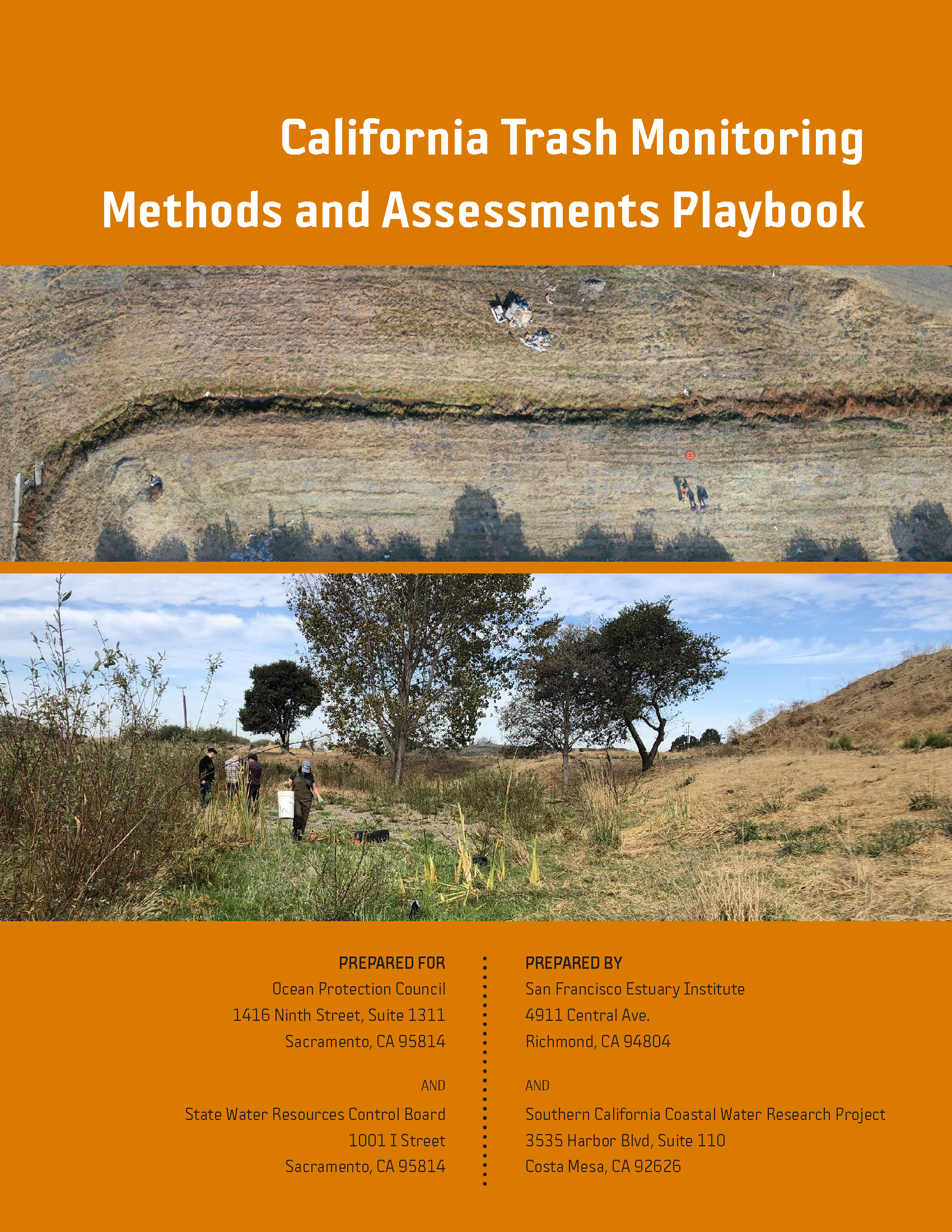
As municipalities and water-quality regulatory agencies have implemented programs and policies to improve management of the trash loading to storm drain conveyances, there has been increased interest in using a common set of methods to quantify the effectiveness of management actions. To create a foundation for developing a consistent, standardized approach to trash monitoring statewide, the project team performed a method comparison analysis, based on two seasons of fieldwork. This analysis facilitated the assessment of the accuracy, repeatability, and efficiency of some already developed trash monitoring methodologies already in use, as well as help to investigate a new, innovative method (cf. Fielding Testing Report on trashmonitoring.org). Methods developed by the Bay Area Stormwater Management Agencies Association (BASMAA) for use in the San Francisco Bay Area were compared to methods developed by the Southern California Stormwater Monitoring Coalition (SMC) for use in coastal southern California. One of the chief goals of these comparisons was to understand the similarities and differences between the already existing methods for detecting, quantifying, and characterizing trash in selected environments. Readers will find that the data bear out remarkable levels of accuracy and precision with quantitative metrics that help to align methods and management concerns. Furthermore, the degree of correlation among tested methods were especially high, offering greater opportunities for inter-method comparisons.
The findings of this project are intended for use by public agencies, non-profit organizations, private consultants, and all of their various partners in informing a statewide effort to adopt rigorous, standardized monitoring methods to support the State Water Board’s Trash Amendments. Over the next couple of decades, such public mandates will require all water bodies in California to achieve water quality objectives for trash.
SFEI is working with partners across the Bay Area to design tools to help cities achieve biodiversity, stormwater, and climate benefits through multifunctional green infrastructure.
SFEI is coordinating the mapping for two inventories of surface waters, wetlands and other aquatic resources in the Sacramento-San Joaquin Delta and along California’s coast. Both efforts will apply the California Aquatic Resource Inventory (CARI) standardized mapping methods and the final map will be integrated into EcoAtlas and made publicly available.
The Ocean Protection Council (OPC) and SFEI will develop an inventory of the wetlands and other surface waters of all California’s coastal HUC-8 watersheds, including the inland Delta of the San Francisco Estuary, to help implement the OPC’s 2020-2025 Strategic Plan. The inventory will include a dashboard and other online tools that enable the OPC and the public to track progress towards multiple O
The Coyote Creek Native Ecosystem Enhancement Tool (CCNEET, neet. ecoatlas.org) is an online decision-support tool to identify opportunities to improve ecological conditions. CCNEET was inspired by the need for a watershed approach to environmental resource management. Available ecological and environmental information is synthesized by objectives, management questions, and enhancement actions to identify and justify potential habitat improvements along the creek corridor. The overarching goal of CCNEET is to help coordinate habitat conservation and enhancement along so that multiple projects and limited funding can result in meaningful ecological improvement.