SFEI is the regional data center for the San Francisco Bay-Delta and its watersheds. Below is a list of our tools for uploading, downloading and visualizing data.
Members from the EDIT team presented SFEI technology projects and capabilities to GreenInfo Network in SF to understand our respective niches and build a stronger partnership between non-profit technology organizations.
Jamie, Marcus, and Greg of the GIS department attended an all-day seminar in San Francisco about the new ESRI software ArcGIS 10. This will be replacing the previous version 9.3, which is currently the software most GIS users rely on for their work. Many changes have been implemented in ArcGIS 10, and we have started a testing period internally within the GIS department before unrolling it company-wide. This seminar focused on cartography, geoprocessing, and web-based GIS applications.
Kristen Cayce, Shira Bezalel and Gregory Tseng successfully released the Beta version of SFEI's Geoportal to the GIS user group at SFEI. The Geoportal team has developed a data management plan that streamlines organization and accessibility of SFEI’s spatial data. The team implemented the latest in geospatial tools, including Geoportal and Spatial Database Engine (SDE), available through Environmental Systems Research Institute (ESRI) to optimize performance of spatial data and improve data management.
The California Environmental Data Exchange Network (CEDEN) is a system designed to facilitate the integration and sharing of data collected by many different participants involved in the water and environmental resources of the State of California.
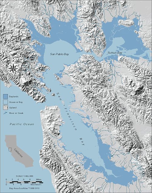
The geographic scope of the San Francisco Wetlands Goals included the portion of the San Francisco Bay-Delta estuary downstream of the Sacramento-San Joaquin Delta. Within this area, the Project designated four primary subregions: Suisun, North Bay, Central Bay, and South Bay.
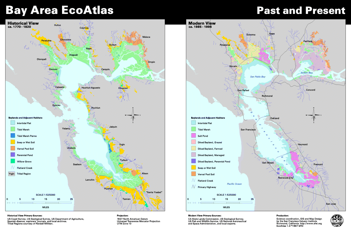
Historical Baylands and Adjacent Habitats ca. 1800
This view of the San Francisco Bay past describes the bays, baylands, and adjacent habitats as they appeared about 200 years ago, when Europeans first arrived in the region.