Marcus talked about methodology, the mapping process, and quality control. Jamie talked about the riparian model, present and future applications, and next steps for BAARI.
Marcus talked about methodology, the mapping process, and quality control. Jamie talked about the riparian model, present and future applications, and next steps for BAARI.
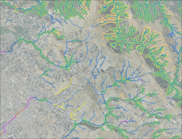
The National Resource Council (NRC) defines riparian as “areas through which surface and subsurface hydrology connect… and significantly influence exchanges of energy and matter”. The riparian area mapping tool (RAMT) was developed as a cost-effective way to map riparian extent as defined by the NRC.
Marcus talked about methodology, the mapping process, and quality control. Jamie talked about the riparian model, present and future applications, and next steps for BAARI.
Marcus talked about methodology, the mapping process, and quality control. Jamie talked about the riparian model, present and future applications, and next steps for BAARI.
The information on this page is provided to help viewers to better understand the data download from the SFEI Contaminant Data Download and Display tool, including the type of data available and how data are presented and handled by SFEI. If you have questions or comments, please contact [email protected].
The Information Technology Program at SFEI supports stewardship of the Estuary by providing tools to compile and disseminate scientific knowledge produced by the organization and its partners. The Program seeks to provide a sound internal infrastructure for SFEI while pursuing more broadly-focused initiatives for the Estuary’s scientific and management community.