Laguna de Santa Rosa Historical Aerial Photomosaic Image from 1942
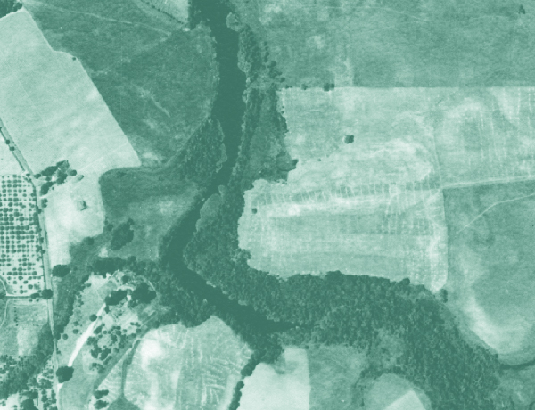
Orthorectified historical aerial photography for the lower Laguna de Santa Rosa watershed was developed as a historical reference tool. The historical aerial photography mosaic was used to develop a reconstruction of the historical landscape and prevailing conditions of lower Laguna de Santa Rosa watershed. This dataset was developed to provide information for watershed management, the restoration of habitats, flood protection, and local education and research. More information about the project is available at http://www.sfei.org/LagunadeSantaRosaHE . This data set andother information about the project is also available at http://sonomavegmap.org/
Creation Date:
Friday, July 11, 2014
Last Updated:
Friday, July 11, 2014
Type of Data:
GIS imagery/raster
Programs and Focus Areas:
Resilient Landscapes Program
Historical Ecology