New Baylands Habitat Map Tracks Restoration Progress

Aug 22, 2024
The Baylands Habitat Map 2020 is the first complete map of San Francisco Bay wetland and aquatic habitats produced since 2009. It provides updated maps of tidal habitats and diked baylands, expanding our understanding of the full impact of recent habitat change and restoration.
Created by the Wetland Regional Monitoring Program and San Francisco Estuary Institute, and funded by the US EPA Water Quality Improvement Fund, this effort marks a major advancement in tracking habitat change in the Bay.
Why is the 2020 Baylands Habitat Map so important to wetland management?
Wetland management and restoration require accurate habitat maps that can quantify changes around the Bay. Past mapping efforts have been essential to understanding changes in the Baylands. An early set of maps developed by SFEI compared marsh extents between the 1850s and 1998, and was key to illustrating the immense magnitude of tidal marsh loss due to environmental degradation. Repeated mapping over time allows us to measure growth of vital wetland habitats due to restoration, and track losses in these habitats due to sea level rise and other factors.
Tracking these changes over time will be increasingly important as rates of sea level rise increase.
Mapping Improved With Automated Techniques
The mapping team used cutting-edge automated approaches, laying the groundwork for consistent mapping and change detection for years to come. The team’s scripted techniques and meticulous ruleset process support consistent, objective, and repeatable mappings. The Baylands Habitat Map can be efficiently updated and used in the future as a critical tool to guide the Bay through changes from sea level rise.
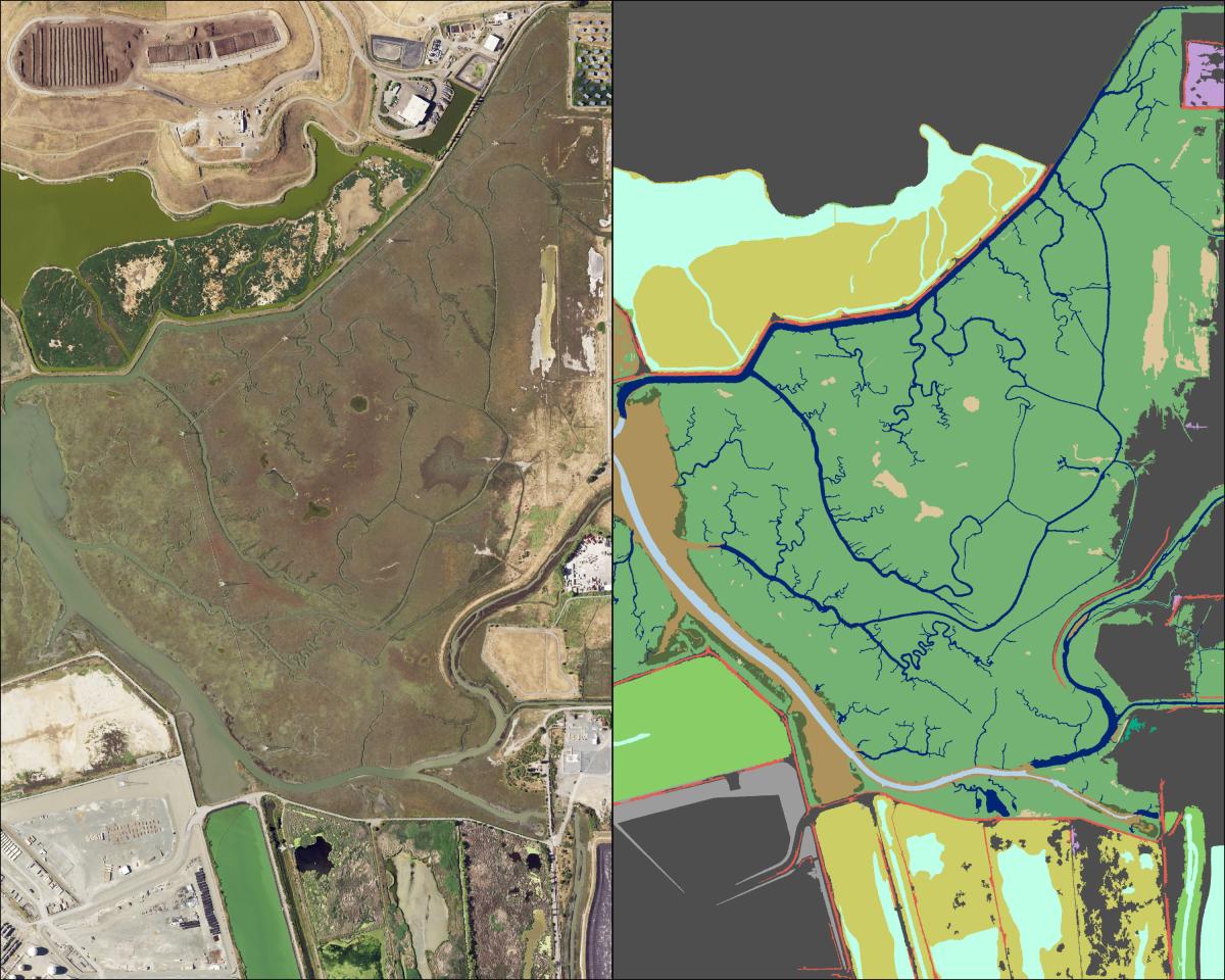
Strides Side by Side
The image below on the left shows an aerial photograph used for classification of Wildcat Marsh in Richmond, while the right image displays the Baylands Habitat Map 2020 for same area.
Associated Staff:
Programs and Focus Areas:
Environmental Informatics Program
Geographic Information Systems
Resilient Landscapes Program
Related Projects, News, and Events:
 Baylands Habitat Map 2020 (Project)
The Baylands Habitat Map 2020 (BHM 2020) updates the existing map of tidal marsh, tidal flats and diked baylands and incorporates the many changes in baylands distribution and abundance that have occurred over the last two decades. It also includes new information about land use and infrastructure that affects baylands restoration and management constraints and opportunities.